Have you ever wished you had a map that highlighted all the hiking trails in city limits? Or maybe you want to visually see where all the libraries and voting polls are located. Look no further, Columbia. Meet GIS mapping — a go-to, visual resource used by the city, local organizations, and passionate locals to help discover data about places in our community.
What is GIS?
GIS (geographic information system) is a tool for gathering, managing + analyzing data. Maps are created through GIS software (like ArcGIS, Google Earth + more) to analyze physical locations and organize layers of info into visualizations in the form of maps + 3D scenes. Simply put, really cool virtually-layered maps.

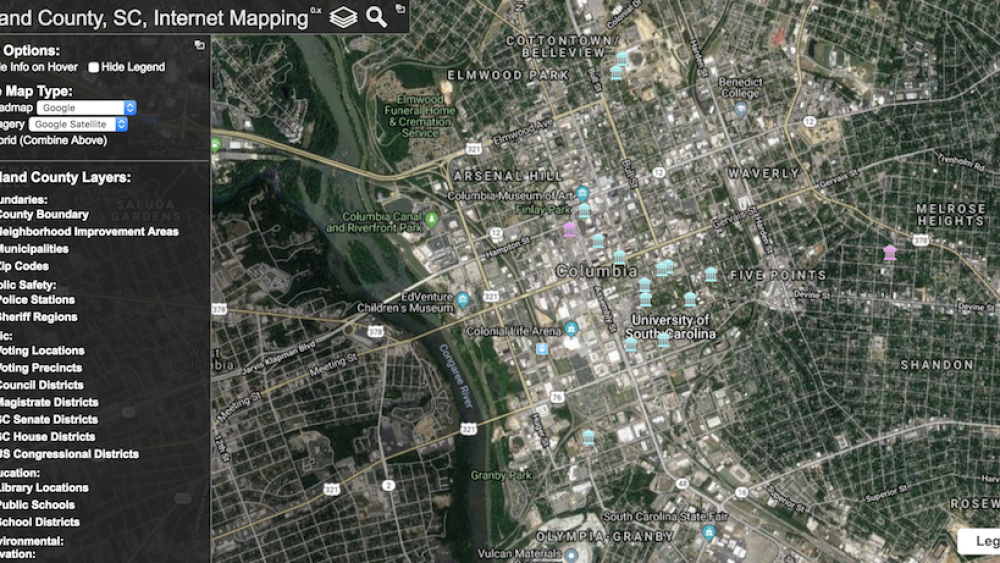
Richland County GIS map showing library locations | Screenshotted by COLAtoday
Who uses GIS?
GIS is used by cities to help the community learn about their city, including trends in the community, specific locations, and more. These maps allow people to communicate, perform analysis, share information, and even solve problems on a local to global level. It’s also used by organizations such as National Parks or local festivals who want to provide visual maps to visitors.
How is it used locally?
City of Columbia has a website dedicated to GIS. Find a mapping of Columbia landmarks, parks, fire stations + more. Explore the Full GIS Access map here, where you can input your address and find a list of neighborhoods, council districts, zoning, trash pickup + more.
Richland County has its own website dedicated to GIS, too. Their website allows you to see land parcel data, voting districts, schools, libraries, police stations, wetland areas + more – all in HD panoramic or high-resolution aerial photos. You can also find 3D modeling for development designs. Type any Richland County address here, and start exploring.
And for our Lexington-resident readers, here’s its website. Find economic developments, where you vote, parks, libraries, and more.
If you’re looking for maps to pair with any of our COLAtoday City Guides here are a couple that may be a great fit:
- Transportation: bus routes, highways, roads + interstates
- School District: local schools in the area
- Parks: all the parks in Columbia
Fun fact — you can explore and create your own local map using GIS software.


